Project Type: Energy
Matilija Dam Ecosystem Restoration Project
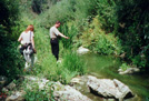
Under a contract with the U.S. Army Corps of Engineers (Corps), the
Aspen Team conducted detailed GIS vegetation mapping for the Ventura
River corridor and Matilija Creek through aerial photo interpretation
and field surveys. The mapping covers the main stems of the Ventura
River and Matilija Creek, a total linear distance of approximately
18 miles. Vegetation communities were delineated as field drawn
polygons onto geo-referenced and ortho-rectified aerial image field
maps that were developed with GIS software. Field-collected data were
digitized into GIS and used to generate vegetation community mosaics.
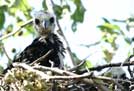
Biological Impact Assessment
Matilija Dam Ecosystem Restoration Project. Aspen provides various
environmental services, including NEPA and CEQA compliance documentation,
for a project to remove Matilija Dam on Matilija Creek, a tributary
of the Ventura River. It also involves removal of Arundo donax along
Matilija Creek and the main stem of the Ventura River. Aspen prepared
a joint EIS/EIR that examines seven project alternative strategies for
removal of the dam and the disposal of sediment accumulated behind the
dam. It also entails downstream improvements to maintain the
flood-carrying capacity of the river and prevent deterioration of
drinking water quality. The various project benefits are also discussed
including: eliminating barriers to steelhead passage; restoring the
natural hydrologic and sediment transport regime; improving riparian
habitat quality; eradicating non-native plant and animal species; and
restoring Matilija Canyon to a more natural, pre-dam condition. Aspen
also supported the project's Environmental Working Group in evaluating
and scoring the quality of existing habitat and projecting habitat
conditions under a future without-project scenario and for each project
alternative.
|