Project Type: Surface Water Drainage
San Luis Rey River Vegetation Mapping
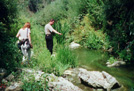
Aspen completed vegetation mapping along the lower seven miles (430 acres) of the
San Luis Rey River. Aerial photography, GPS and walking transects were used to map
plant communities. A GIS analysis determined the acreage of good and poor quality
riparian habitat for least Bell's vireo based on cover and composition attributes
recorded during the survey.
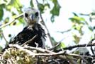
Biological Impact Assessment
San Luis Rey River Biological Assessment. Aspen completed a biological assessment
for the U.S. Army Corps of Engineers of eight federally listed threatened and
endangered birds, amphibians, and fish. The impact of proposed vegetation clearing
and sediment removal on the species and their habitat was assessed based on
hydrological modeling results, vegetation surveys, and wildlife population data;
over 20 detailed mitigation measures were defined.
|